
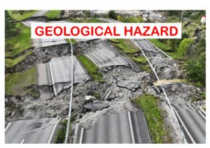
We live on a dynamic planet. Beneath the surface of our seemingly solid Earth lies a world in constant motion — shifting plates, grinding faults, rising magma, and flowing debris. While this restless energy shapes mountains, builds continents, and supports ecosystems, it also brings danger. When nature’s forces erupt suddenly and violently, we face what scientists call geological hazards.
These hazards from earthquakes to landslides, have shaped human history, altered landscapes, and claimed countless lives. In this article, we’ll explore some of the most significant geological hazards in the world, how they form, where they strike, and what we can do to live more safely on our restless Earth.
Earthquakes
If there’s one geological hazard that strikes without warning, it’s an earthquake. Caused by the sudden release of stress along faults or fractures in the Earth’s crust, earthquakes send shockwaves through the ground, shaking buildings, cracking roads, and toppling infrastructure.
Why Earthquakes Happen?
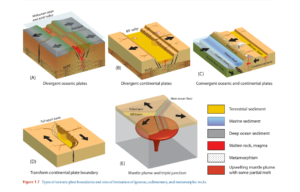
Most earthquakes occur along tectonic plate boundaries, where the Earth’s plates meet and grind against each other. The energy builds up slowly over years or centuries and is released in seconds.
Where do earthquakes strike?
Some of the most earthquake-prone regions include:
- The Ring of Fire around the Pacific Ocean (Japan, Indonesia, Chile, etc.)
- The Himalayan region, including Nepal and northern India
- Parts of California, along the San Andreas Fault
Impact of Earthquake:
The 2010 Haiti earthquake and the 2004 Indian Ocean earthquake (which triggered a devastating tsunami) are stark reminders of how deadly these events can be. The challenge isn’t just the shaking itself, but the vulnerability of the buildings and people above.
Volcanic Eruptions
Volcanic eruptions are one of the most dramatic and dangerous geological hazards, capable of causing widespread destruction and long-term environmental change. They occur when magma, gases, and volcanic ash are expelled from a volcano due to intense pressure from beneath the Earth’s surface. These eruptions can range from slow lava flows to catastrophic explosive events.
The hazards associated with volcanic eruptions include lava flows, which destroy everything in their path; pyroclastic flows, which are fast-moving currents of hot gas and volcanic matter that can annihilate entire communities; ash fall, which disrupts air travel, damages crops, contaminates water supplies, and causes respiratory issues; and volcanic gases, such as sulfur dioxide and carbon dioxide, which can be toxic to humans and animals and contribute to acid rain and climate effects.
Long-term impacts may include changes to landscapes, disruption of ecosystems, and temporary cooling of global temperatures due to ash and aerosols in the atmosphere. Populations living near active volcanoes are especially vulnerable, and the unpredictability of eruptions makes preparedness and monitoring critical. Geologists and volcanologists use seismic data, gas emissions, ground deformation, and satellite imagery to monitor volcanic activity and issue early warnings to reduce the risk to human life and infrastructure.
Volcanic eruptions, while hazardous, also play a constructive role over geological time by forming fertile soils, new land, and mineral deposits, highlighting the dual nature of this powerful Earth process.
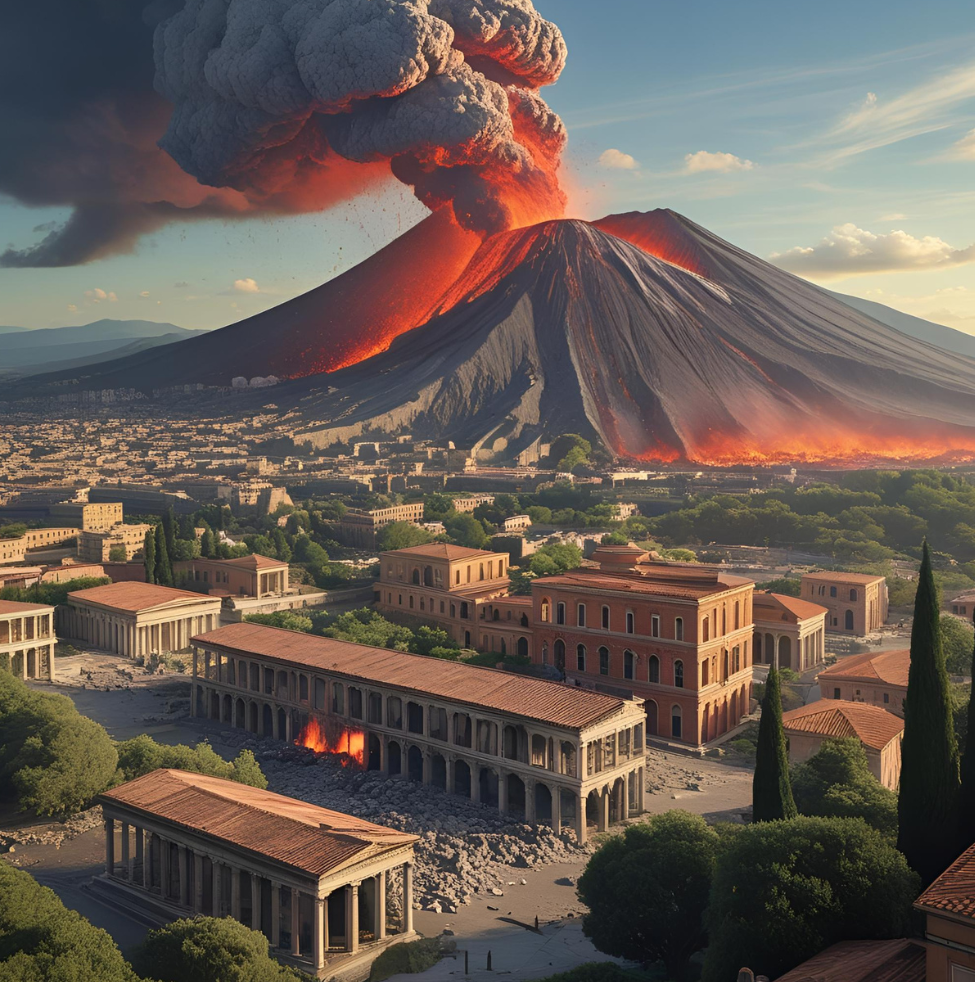
Deadly Volcanic Eruptions
- Mount Vesuvius (AD 79) buried Pompeii.
- Krakatoa (1883) caused massive tsunamis and global climate effects.
- Mount St. Helens (1980) changed the landscape of Washington State.
Today, Mount Etna, Mount Merapi, and Kilauea are among the most active volcanoes, continuously reminding us of their presence.
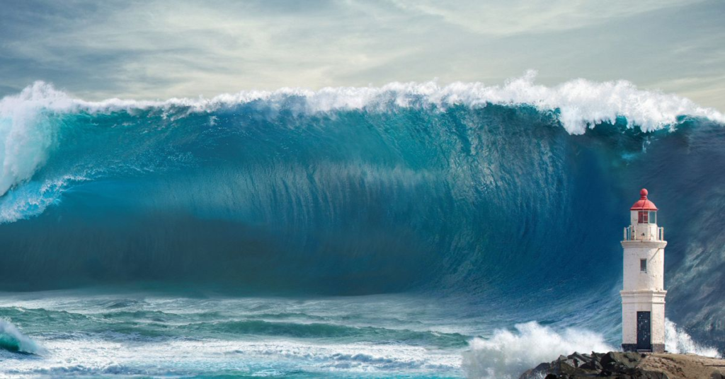
Tsunamis
A tsunami is not just a big wave — it’s a series of waves caused by underwater disturbances, usually earthquakes. These waves travel at jetliner speeds across the ocean and rise dramatically when they reach shallow coastal waters.
Causes of Tsunamis
Tsunamis are triggered primarily by:
- Submarine earthquakes
- Underwater landslides
- Volcanic eruptions or even meteor impacts
Deadliest Tsunami Event
The 2004 Indian Ocean tsunami, triggered by a magnitude 9.1 earthquake off Sumatra, killed over 230,000 people across 14 countries. It remains one of the deadliest natural disasters in recorded history.
Tsunamis are particularly dangerous because they can strike with little warning and affect distant coastlines hours after the initial event.
Landslides
Landslides are the downward movement of rock, earth, or debris due to gravity. They can be sudden or slow, and often follow heavy rainfall, earthquakes, volcanic eruptions, or human activities like mining or deforestation.
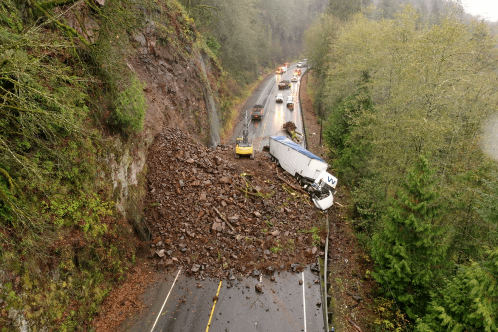
Types of landslides
- Debris flows: Fast, wet, and often deadly
- Rockfalls: Sudden collapse of rock from cliffs
- Creep: Slow, gradual movement of soil or rock
Global Hotspots of landslides
Mountainous regions like the Himalayas, Andes, and Alps are especially vulnerable. In 2013, a landslide in Uttarakhand, India, compounded by heavy monsoon rains and unregulated development, caused widespread destruction and loss of life.
Landslides are often underestimated but cause significant damage and fatalities every year.
Sinkholes
Sinkholes can seem like something from a science fiction movie, the ground suddenly collapses and swallows whatever is above it. In reality, they’re a geological hazard linked to the dissolution of soluble rocks like limestone, gypsum, and salt.
Why do sinkholes occur?
When underground cavities formed by dissolving rock become too large to support the overlying material, the ground collapses. Sinkholes are often triggered by:
- Excessive groundwater pumping
- Heavy rainfall
- Construction or drilling
Notable Cases of sinkholes
In 2013, a man in Florida tragically died when a sinkhole opened beneath his bedroom. In Guatemala City, massive urban sinkholes have appeared due to poor drainage and weak subsurface conditions.
While sinkholes may not be as widespread as other hazards, their sudden and unpredictable nature makes them particularly alarming.
Liquefaction:
Liquefaction occurs during strong earthquakes when saturated, loose soils temporarily lose their strength and behave like a liquid. This causes buildings and roads to tilt, sink, or collapse — even if they weren’t directly damaged by the quake.
How Liquefaction Happens?
As seismic waves pass through the ground, water pressure between soil particles increases, reducing friction and stability. Structures built on such soils are especially vulnerable.
Where is the Risk of liquefaction?
Coastal cities and river plains built on reclaimed or waterlogged land are most susceptible, like Christchurch, New Zealand, where liquefaction caused widespread damage during the 2011 earthquake.
Subsidence:
Subsidence is the gradual sinking of the Earth’s surface due to natural or human causes. Unlike sudden sinkholes, subsidence usually unfolds slowly, but its impact can be equally severe.
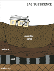
Causes of Subsidences
- Natural compaction of sediments
- Groundwater or oil extraction
- Mining activities
Examples of subsidences
- Jakarta, Indonesia, is sinking by several centimeters each year.
- Parts of California’s Central Valley have subsided by over 30 feet due to excessive groundwater pumping.
Subsidence doesn’t grab headlines like earthquakes, but it affects infrastructure, agriculture, and urban development on a global scale.
Mitigation of geological hazards
While geological hazards can’t be prevented, their impacts can be mitigated through science, planning, and public awareness. Here’s how:
- Monitoring and Early Warning: Networks of seismographs, GPS stations, satellites, and volcano observatories help detect early signs of activity.
- Engineering Solutions: Earthquake-resistant buildings, tsunami barriers, and proper drainage systems reduce risks.
- Education and Drills: Knowing how to react in an emergency, whether during a quake or evacuation, saves lives.
- Land Use Planning: Avoiding construction in hazard-prone zones is critical for long-term safety.
FAQs on geohazard
1. What are geohazards?
Geohazards are naturally occurring geological conditions or processes that pose a threat to people, property, and the environment. These include earthquakes, landslides, volcanic eruptions, tsunamis, sinkholes, and floods caused by geological factors. Understanding and managing geohazards is essential for minimizing risks to human life and infrastructure.
2. How do earthquakes act as geohazards?
Earthquakes are sudden movements of the Earth’s crust caused by the release of built-up stress along geological faults. They can lead to ground shaking, surface rupture, liquefaction, and even tsunamis. In populated areas, strong earthquakes can cause widespread destruction of buildings, bridges, roads, and utilities.
3. What causes landslides and how hazardous are they?
Landslides occur when soil, rocks, or debris slide down a slope due to gravity, often triggered by rainfall, earthquakes, volcanic activity, or human disturbance. They can destroy homes, block roads, and disrupt ecosystems. In mountainous and hilly regions, landslides are a major geohazard, especially during monsoon seasons.
4. Why are volcanic eruptions considered dangerous?
Volcanic eruptions release lava, ash, gases, and pyroclastic flows that can cause massive destruction. Ash clouds can affect air travel, while toxic gases can harm health. Pyroclastic flows and lava can obliterate settlements. Even dormant volcanoes pose a risk if not properly monitored.
5. What is a tsunami and how is it related to geohazards?
Tsunamis are large sea waves caused by underwater earthquakes, volcanic eruptions, or landslides. They can travel across oceans at high speeds and inundate coastal areas, causing extreme flooding, destruction, and loss of life. Coastal monitoring and early-warning systems are vital for tsunami risk reduction.
6. How do sinkholes form, and why are they hazardous?
Sinkholes form when underground rock (often limestone) dissolves due to water, creating a cavity that eventually collapses. These sudden ground failures can swallow buildings, roads, and vehicles, posing serious risks in karst regions where such geology is prevalent.
7. What role does climate play in triggering geohazards?
Climate influences geohazards such as landslides and floods. Intense rainfall, rapid snowmelt, and droughts can destabilize slopes or cause soil erosion. Climate change is likely to increase the frequency and severity of certain geohazards due to more extreme weather patterns.
8. Can human activity trigger geohazards?
Yes, human activities like mining, deforestation, construction, and groundwater extraction can exacerbate or even trigger geohazards such as landslides, subsidence, or induced earthquakes. Sustainable land-use planning is necessary to reduce these risks.
9. How are geohazards monitored?
Geohazards are monitored using seismographs, GPS systems, remote sensing satellites, weather stations, and field observations. Early-warning systems based on these tools help authorities take timely action to minimize impacts.
10. What is the role of geology in geohazard mitigation?
Geologists study the Earth’s structure, rock types, and past geological activity to identify hazardous zones. Their expertise helps in hazard mapping, risk assessment, land-use planning, and designing structures that are more resistant to natural hazards.
11. How can communities prepare for geohazards?
Preparedness involves public education, emergency drills, hazard mapping, and development of evacuation plans. Strengthening building codes and ensuring disaster-resilient infrastructure also play a crucial role in minimizing risks.
12. Are all geohazards sudden events?
Not all geohazards are sudden. Some, like land subsidence or slow-moving landslides, develop over time and provide early warning signs. Others, like earthquakes or tsunamis, can occur with little or no notice, making real-time monitoring critical.
13. What is the difference between natural hazards and geohazards?
Natural hazards include all types of natural disasters—meteorological (like cyclones), hydrological (like floods), and geological. Geohazards are a subset focused specifically on hazards arising from Earth’s internal and surface geological processes.
14. Why is geohazard zoning important?
Geohazard zoning involves identifying and categorizing areas based on their susceptibility to geological hazards. It helps planners and developers avoid high-risk zones and design safer infrastructure, reducing the potential impact of disasters.
15. Can technology help reduce the risk of geohazards?
Yes, advanced technology like GIS, LiDAR, satellite imagery, and AI-powered early warning systems significantly improve our ability to detect, assess, and respond to geohazards. These tools support timely decision-making and help save lives and property.

Hmm is anyone else experiencing problems with the images on this blog loading?
I’m trying to figure out if its a problem on my end or if it’s the blog.
Any suggestions would be greatly appreciated.
Good day I am so happy I found your blog page, I really
found you by accident, while I was searching on Google for something else, Anyways
I am here now and would just like to say many thanks
for a incredible post and a all round entertaining blog (I also love the theme/design), I don’t
have time to read through it all at the minute but I have bookmarked it and also included your RSS feeds,
so when I have time I will be back to read a lot more, Please do keep up the excellent work.
This design is wicked! You certainly know how to keep a reader amused.
Between your wit and your videos, I was almost moved to start my own blog (well, almost…HaHa!) Great job.
I really enjoyed what you had to say, and more than that, how you presented it.
Too cool!
We absolutely love your blog and find nearly all of your post’s to
be precisely what I’m looking for. can you offer guest writers to write content for you?
I wouldn’t mind publishing a post or elaborating on a lot of the subjects you write regarding here.
Again, awesome website!
Great information. Lucky me I came across your site by chance (stumbleupon).
I’ve book marked it for later!
Great post! We are linking to this great article on our website.
Keep up the great writing.