Geology, long viewed as a boots-on-the-ground science, is undergoing a quiet but powerful revolution. With the rise of Artificial Intelligence (AI) and Machine Learning (ML), the way we study, interpret, and interact with the Earth is transforming at an unprecedented pace. Once driven solely by field observations and manual analysis, geology is now increasingly data-driven, with algorithms working behind the scenes to help us uncover hidden mineral deposits, predict earthquakes, and analyze rock samples — faster and more accurately than ever before.
In this article, we’ll explore how AI and ML are being used across various branches of geology and why every geologist, from students to seasoned professionals, should consider adding a bit of “data science” to their toolkits.
Understanding AI and ML in Simple Terms
Before diving into applications, let’s break down what we mean by Artificial Intelligence and Machine Learning — terms that are often used interchangeably but aren’t quite the same.
- Artificial Intelligence (AI) is the broader concept of machines or software systems that can perform tasks that usually require human intelligence — such as learning, reasoning, and decision-making.
- Machine Learning (ML) is a subset of AI. It’s all about teaching computers to learn from data, identify patterns, and make predictions or decisions without being explicitly programmed for each scenario.
In geology, we often deal with huge amounts of complex, noisy, and nonlinear data — from satellite images and geophysical logs to geochemical assays and seismic waves. This is exactly where AI and ML shine.
Mineral Exploration
One of the most promising applications of AI/ML in geology is in mineral exploration. Traditionally, mineral prospecting involved extensive fieldwork, manual sampling, and geochemical analysis — all time-consuming and costly. Now, ML algorithms can be trained on existing exploration data to predict areas with high mineral potential.
For instance, decision tree models, support vector machines (SVMs), and random forests can analyze layers of geophysical, geological, and remote sensing data to highlight prospective zones for uranium, copper, gold, or rare earth elements. These tools can even uncover subtle patterns that the human eye might miss, pointing exploration teams to new frontiers with reduced costs and improved efficiency.
Remote Sensing and Satellite Image Analysis
Remote sensing has always been a powerful tool in geology. But with the availability of high-resolution multispectral and hyperspectral satellite data, traditional image interpretation methods are struggling to keep up.
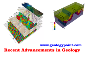
That’s where machine learning comes in. Algorithms like Convolutional Neural Networks (CNNs) — a type of deep learning model — can automatically classify land cover, detect structural features like faults or lineaments, and even map alteration zones linked to mineralization. ML models can handle large datasets from sources like Landsat, Sentinel, or ASTER and produce fast, accurate interpretations that would take a human analyst days or weeks.
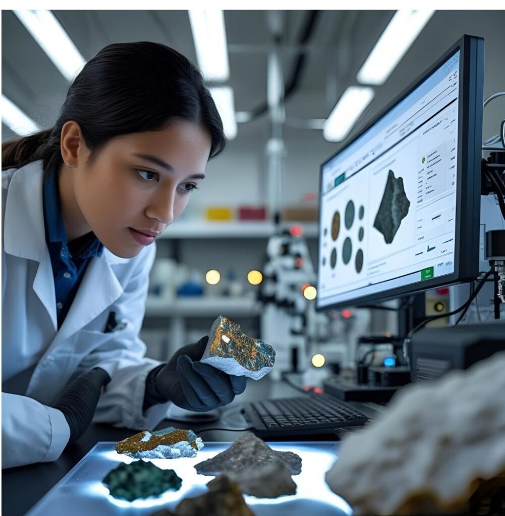
Petrography and Thin Section Analysis
If you’ve ever spent hours looking at rock thin sections under a microscope, manually identifying mineral grains and estimating textures, you’ll appreciate this next application.
AI is now being used to automate the classification of thin section images. Using computer vision and deep learning models, it’s possible to segment individual mineral phases, estimate grain size distributions, identify porosity, and even detect microfractures — all within seconds. This kind of automation not only saves time but also minimizes human error, making petrographic analysis more consistent and scalable.
In research environments, this has been particularly useful in sedimentology, petrology, and reservoir rock studies, where accurate mineral quantification plays a key role in interpretation.
Earthquake Prediction and Seismic Data Analysis
While predicting earthquakes remains one of the biggest challenges in geoscience, AI is helping us get closer. Seismologists are using ML models to analyze large volumes of seismic data to detect patterns that precede seismic events.
For example, recurrent neural networks (RNNs) can be trained on time-series seismic signals to identify foreshocks, monitor stress accumulation, or even predict the likelihood of an aftershock. ML algorithms are also being used for real-time earthquake detection and to improve the accuracy of earthquake early warning systems, which can save lives in high-risk zones.
Oil and Gas Reservoir Modeling
In the oil and gas sector, AI is playing a crucial role in reservoir characterization and production optimization. Geological and geophysical data — such as well logs, seismic profiles, and core samples — are often too voluminous and complex for traditional interpretation methods.
Machine learning can integrate these datasets to predict porosity, permeability, lithofacies, and other reservoir properties. Classification algorithms can group rock types, while regression models can estimate continuous parameters. This leads to better 3D models of the subsurface and more informed drilling decisions.
Moreover, AI-based systems are used for real-time monitoring of drilling operations, anomaly detection, and even predicting equipment failures — improving both safety and efficiency.
Groundwater and Environmental Geology
ML isn’t just for oil, gas, and minerals — it’s increasingly being used in environmental geology and hydrogeology too. AI models can help predict groundwater contamination, assess aquifer health, and model water table fluctuations based on climatic and geological inputs.
For example, supervised learning models can predict arsenic contamination in groundwater based on soil chemistry and geology. In environmental risk assessments, AI tools can also be used to simulate pollutant dispersion and land-use changes.
Challenges and Future Directions
Despite its advantages, applying AI in geology isn’t without challenges. Geological data can be sparse, imbalanced, or noisy. Interpreting ML results also requires geological insight — models are only as good as the data and assumptions they’re trained on.
However, the future looks promising. With more open-source geoscience datasets, better computing power, and interdisciplinary collaboration between geologists and data scientists, we’re seeing the birth of the “digital geologist” — one who blends field expertise with machine intelligence.
FAQs on role of AI and ML in geology
1. What is the role of AI and ML in geology?
AI and ML are increasingly being used in geology to analyze large and complex datasets more efficiently. These technologies help in pattern recognition, predictive modeling, anomaly detection, and data integration, which are crucial for mineral exploration, geological mapping, and hazard assessment.
2. How does machine learning help in mineral exploration?
Machine learning models can process geological, geochemical, and geophysical data to identify patterns and relationships that may not be visible to the human eye. These models help predict potential mineralized zones, reducing exploration costs and time while increasing success rates.
3. Can AI improve geological mapping?
Yes, AI techniques like image recognition and classification algorithms can process satellite imagery, drone data, and geospatial information to automatically classify rock types, structures, and alterations. This significantly speeds up geological mapping and reduces human error.
4. What types of geological data can be used with AI?
AI can process various types of geological data such as seismic data, core logs, well data, remote sensing images, geochemical assays, hyperspectral images, and structural data. The integration of multi-source datasets helps build more accurate geological models.
5. How is AI used in seismic interpretation?
In seismic interpretation, AI algorithms can automate the detection of faults, horizons, and other subsurface features. Deep learning models are particularly effective in identifying subtle patterns in seismic data that are useful for oil and gas exploration.
6. What are some AI techniques commonly used in geology?
Common AI and ML techniques include neural networks, support vector machines (SVM), decision trees, k-means clustering, random forests, and convolutional neural networks (CNN). These methods are used based on the type and volume of data being analyzed.
7. Can AI assist in predicting natural hazards?
AI models can analyze historical and real-time data to predict geological hazards like landslides, earthquakes, volcanic eruptions, and floods. Machine learning helps assess risk levels and issue early warnings by recognizing precursors and risk factors.
8. What is the use of AI in petroleum geology?
AI and ML are used in petroleum geology for reservoir characterization, production forecasting, and drilling optimization. These tools improve decision-making by analyzing core, log, and seismic data to understand subsurface behavior and enhance hydrocarbon recovery.
9. Is AI used in groundwater and hydrogeology studies?
Yes, AI models are used to predict groundwater availability, aquifer properties, and contamination risks. ML techniques help analyze hydrogeological datasets to simulate water flow, recharge rates, and pollutant transport with greater accuracy.
10. How does AI contribute to geotechnical engineering?
In geotechnical engineering, AI is used to model soil behavior, slope stability, and foundation design parameters. ML algorithms help in processing laboratory and field test data to predict mechanical properties and failure risks of soil and rock masses.
11. Are there any real-time applications of AI in geology?
Real-time applications include monitoring systems that use AI to assess data from sensors installed in mines, tunnels, or earthquake-prone areas. These systems can provide early warnings, track structural integrity, or detect gas leaks, improving operational safety.
12. What are the limitations of using AI in geology?
Limitations include data quality issues, overfitting of models, lack of interpretability, and the need for domain-specific training data. AI models require large and accurate datasets, and their predictions still need to be validated by geologists through fieldwork or testing.
13. How can geologists learn to use AI and ML?
Geologists can start by learning data science fundamentals, coding languages like Python or R, and specialized software such as TensorFlow or Scikit-learn. Many universities and online platforms now offer courses on AI applications tailored to earth sciences.
14. What industries benefit from AI in geology?
Industries like mining, oil and gas, environmental consulting, water resource management, and geotechnical construction benefit significantly from AI applications in geology. These tools enhance productivity, reduce costs, and improve decision-making in subsurface investigations.
15. What is the future of AI in geological sciences?
The future of AI in geology looks promising, with advancements expected in autonomous exploration systems, real-time hazard detection, AI-driven drilling platforms, and integration with other technologies like GIS and remote sensing. As data availability increases, AI will become even more central to geological innovation.